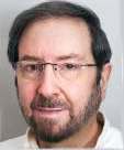
Ellis Freedman - Founder and Owner
EXPERIENCE:
2021 - 2023 Consultant to constellr GmbH
Heinrich-von-Stephan-Str. 5c
79100 Freiburg | Germany
Providing algorithm development, systems engineering, and performance analyses in support of a high resolution long wave IR imaging satellite constellation intended for land surface temperature measurements and the evaluation of agricultural evapotranspiration and soil organic carbon.
2019 - 2020 Innovative Imaging and Research Corp.,
NASA Stennis Space Center, MS
Part time employee for a variety of research and analysis tasks including the development of a prototype hydrogen and hydrocarbon flame detection, identification and location system.
2010 - Present Owner of Serious Science LLC
Provided design and analysis support to Lockheed Martin Corporation and NASA Goddard on the Sustainable Land Imaging Program.
1983 - 2010 Lockheed Martin Corporation, Integrated Systems & Global Services (Formerly General Electric Aerospace) Valley Forge, Pa.
1991 - 2010 Lockheed Martin Fellow - Chief engineer for the calibration of electro-optic sensors and the processing of raw data into imagery for large government and commercial remote sensing systems. Designed the high level architecture for large data processing systems. Developed mathematical algorithms, modeling tools, and processing techniques for the correction, enhancement, and exploitation of imagery, and the characterization, detection, and removal of artifacts and noise. Led the development, integration, and implementation of a variety of visible, infrared, radar, multispectral and hyperspectral hardware/software systems, established performance requirements, developed specs from the component to the system level, and performed end-to-end project planning.
Co-developer of a high accuracy, radiometric MTF correction filter.
Developed an algorithm for estimating ground temperature from space using two mid-wave IR spectral bands and no atmospheric information.
Developed an algorithm for estimating ground reflectance from space using blue and red spectral bands and no atmospheric information.
Chief Scientist for the Lockheed Martin Corporation pursuit of the Landsat Data Continuity Mission.
Supported the design of the NASA Stennis Space Center Commercial Remote Sensing Program validation and verification ground truth conops for the performance validation of the next generation of commercial imaging satellites.
Constructed an algorithm, using modern control theory, for the fusion of data from different radiometric calibrators to estimate the state of detectors on the Landsat 7 Enhanced Thematic Mapper Plus with greater accuracy than had ever been achieved before by a spaceborne sensor.
Developed and implemented techniques for the removal of image artifacts in Landsat 7 imagery that could also be used to correct all imagery collected over the previous 12 years by the other Landsat Thematic Mappers.
Provided a technique for the removal of a severe imaging artifact caused by the calibration system in Space Imaging, Inc.'s Ikonos Commercial Remote Sensing System.
Developed and implemented an image compaction algorithm which reduces storage requirements by more than one third with insignificant quality losses.
1990 - 1991 Unit Manager - Responsible for the leadership, technical guidance and administrative oversight of 14 engineers, including project planning, performance appraisals, salary actions, manpower schedules, training, promotions, hirings and dismissals, as well as for the fiscal planning of an annual budget of more than $2 million.
1983 - 1990 Systems Engineer - Responsible for sensor radiometric calibration algorithm development, signal and image processing development, operations support, system performance analyses, system requirements development, statistical analyses, and atmospheric modeling.
Developed an algorithm for identifying and removing 99% of random bit errors and errors caused by cosmic ray impacts on a satellite.
Developed the algorithms and software for the calibration and processing of sensor data from an aircraft test bed program.
Technical lead for the resolution of anomalous behavior in an operational environment.
1978 - 1983 Veda Inc. Southampton, Pa.
Senior Systems Engineer - Responsible for the performance evaluation and modeling of state of the art fire control, radar, missile, and avionics systems. Project Manager for the evaluation of advanced technologies such as spread spectrum, adaptive null forming, frequency agility, infrared search and track, and ducted rocket propulsion.
Developed an M vs. N air to air engagement simulation that modeled the movements and interactions of any number of vehicles and their associated fire control and missile systems.
Developed a passive ranging algorithm for use by airborne EO sensors for implementation in the F- 14 and F- 15.
Lead engineer in the development of an optimized steering algorithm for the F-14.
PUBLICATIONS:
Removal of Thematic Mapper Streaking and Striping Artifacts, International Society for Photogrammetry and Remote Sensing (ISPRS) InterCommission Workshop, Vol.30, Part 5W1, "From Pixels to Sequences", March 22-24,1995, Zurich, Switzerland.
Combining Multiple Sources for Radiometric Calibration of Landsat 7 Using a Kalman Filter, International Society for Photogrammetry and Remote Sensing (ISPRS) InterCommission Workshop, Vol. 30, Part 5W1, "From Pixels to Sequences", March 22-24,1995, Zurich, Switzerland.
Spectral Dark Subtraction: A MODTRAN-Based Algorithm for Estimating Ground Reflectance without Atmospheric Information, JACIE High Resolution Imagery Workshop, March 14, 2006.
A Constant MTF Resampler, JACIE High Resolution Imagery Workshop, April 17, 2012
New MTF Resampling Kernel and Its Effect on RapidEye Imagery, JACIE High Resolution Imagery Workshop, April 17, 2013
An Update on the Constant MTF Interpolator, JACIE High Resolution Imagery Workshop, March 26, 2014
The Constant MTF Interpolator: A Resampling Technique with Minimal MTF Losses, IEEE Signal Procesing in Medicine and Biology, December 3, 2016
Using the Constant MTF Resampler to Reduce Aperture Size in Imaging Systems, JACIE High Resolution Imagery Workshop, September 19, 2017
PROFESSIONAL HONORS:
Award for Professional Recognition for Individual Dedication and Excellence 1987
Award for Professional Recognition for Individual Dedication and Excellence 1994
General Manager's Award 1994
Customer Recognition Award 1995
Lockheed Martin Special Incentive Award 1996
Customer Recognition Award 1996
Management Award for Support of GEROS Proposal 1996
Lockheed Martin Special Incentive Award 1997
Lockheed Martin Special Recognition Award 1997
Lockheed Martin On the Spot Award 1998
Award for Professional Recognition for Individual Dedication and Excellence 1999
Customer Certificate of Appreciation for Mission Success 2003
Lockheed Martin Special Recognition Award 2004
Team Excellence Award 2005
Awarded position of Lockheed Martin Fellow 2007
Lockheed Martin IS&GS Team Excellence Award 2010
Customer Appreciation Award 2010
EDUCATION:
1977 Northeastern University, Boston, Ma.
M.S. Physics
1976 Temple University, Philadelphia, Pa.
B.S. Physics


